
1954 Map of Jabez
USGS Topo · Published 1955About this map
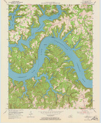
Lake Cumberland dominates this mid-century landscape along the Russell and Wayne county line. The reservoir’s intricate, branching shoreline follows the deep contours of the Cumberland River valley, isolating high-ground features like Polston Ridge and Cave Springs Ridge into dramatic peninsulas. Small communities and family centers such as Jabez and Ono occupy the surrounding ridges, marked by a density of country schools and churches including the House of Prayer and Mount Pleasant Ch.
Find a feature on this map
68 named features on this map. Tap any name to fly to it.
Don’t see what you’re looking for? This feature index may not catch every label — zoom into the map to look around manually.
Map Details
Editions of this 1954 Jabez Map
2 editions found
Other maps of this area

1911 · Monticello
USGS Topo · 1:62,500

1914 · Monticello
USGS Topo · 1:62,500

1953 · Parnell
USGS Topo · 1:24,000

1953 · Monticello
USGS Topo · 1:24,000

1953 · Mill Springs
USGS Topo · 1:24,000

1953 · Jamestown
USGS Topo · 1:24,000

1954 · Cumberland City
USGS Topo · 1:24,000

1954 · Russell Springs
USGS Topo · 1:24,000

1954 · Eli
USGS Topo · 1:24,000
1954 · Faubush
USGS Topo · 1:24,000