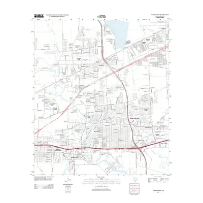
2013 Map of Jacinto City
USGS Topo · Published 2013About this map
Greens Bayou and Halls Bayou wind through a dense network of suburban developments east of Houston in the early 21st century. The map reveals a transition from the industrial and residential corridors of Cloverleaf and Beaumont Place to the significant water resources of the Sheldon Reservoir and the Sheldon Fish Hatchery. The landscape is defined by its drainage patterns, with Sulphur Gully, Big Gulch, and Jordan Gully cutting through established neighborhoods like Wood Forest and Sterling Green. Genealogists and local historians can locate the Harris County Cem and the Robert E Lee Sch, providing anchors for family research in this rapidly evolving part of Harris County. The road network, including Tidwell Rd and Wallisville Rd, connects numerous distinct subdivisions such as Oates Prairie and Pine Trails.
Find a feature on this map
161 named features on this map. Tap any name to fly to it.
Don’t see what you’re looking for? This feature index may not catch every label — zoom into the map to look around manually.
Map Details
Editions of this 2013 Jacinto City Map
This is the sole edition of this map. No revisions or reprints were ever made.
Other maps of this area

1915 · Park Place
USGS Topo · 1:24,000

1915 · Deepwater
USGS Topo · 1:24,000

1916 · Burnett Bay
USGS Topo · 1:24,000

1916 · Crosby
USGS Topo · 1:24,000

1916 · Settegast
USGS Topo · 1:24,000

1916 · Fauna
USGS Topo · 1:24,000

1916 · Harmaston
USGS Topo · 1:24,000

1916 · Humble
USGS Topo · 1:24,000

1916 · La Porte
USGS Topo · 1:24,000

1919 · Deepwater
USGS Topo · 1:31,680