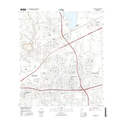
2016 Map of Jacinto City
USGS Topo · Published 2016About this map
Greens Bayou and Hunting Bayou define the drainage of this industrial and residential landscape east of Houston. The map illustrates a densely woven network of neighborhoods and commercial corridors, including Jacinto City, Cloverleaf, and Channelview. To the north, the Sheldon Reservoir provides a major hydrological landmark, while the S Pacific railroad line cuts across the terrain, reflecting the area's long-standing connection to regional transport and trade.
Find a feature on this map
304 named features on this map. Tap any name to fly to it.
Don’t see what you’re looking for? This feature index may not catch every label — zoom into the map to look around manually.
Map Details
Editions of this 2016 Jacinto City Map
This is the sole edition of this map. No revisions or reprints were ever made.
Other maps of this area

1915 · Park Place
USGS Topo · 1:24,000

1915 · Deepwater
USGS Topo · 1:24,000

1916 · Burnett Bay
USGS Topo · 1:24,000

1916 · Crosby
USGS Topo · 1:24,000

1916 · Settegast
USGS Topo · 1:24,000

1916 · Fauna
USGS Topo · 1:24,000

1916 · Harmaston
USGS Topo · 1:24,000

1916 · Humble
USGS Topo · 1:24,000

1916 · La Porte
USGS Topo · 1:24,000

1919 · Deepwater
USGS Topo · 1:31,680