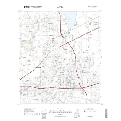
2019 Map of Jacinto City
USGS Topo · Published 2019About this map
Greens Bayou and its numerous tributaries, including Big Gulch and Jordan Gully, define the drainage of this dense industrial and residential corridor east of Houston. This 2019 survey captures the complex infrastructure of eastern Harris County, where the massive Sheldon Reservoir sits to the north and the heavily developed areas of Jacinto City and Galena Park occupy the southern reaches. The landscape is a matrix of transit and commerce, bisected by major arteries like the Sam Houston Pkwy and Beltway 8. Local history is visible in the established neighborhoods of Cloverleaf and Beaumont Place, alongside memorial sites such as San Jacinto Memorial Park and the Harris County Cem. The map illustrates the persistent intersection of the region's natural bayou system with the expansive growth of the ship channel's inland reach.
Find a feature on this map
26 named features on this map. Tap any name to fly to it.
Don’t see what you’re looking for? This feature index may not catch every label — zoom into the map to look around manually.
Map Details
Editions of this 2019 Jacinto City Map
This is the sole edition of this map. No revisions or reprints were ever made.
Other maps of this area

1915 · Park Place
USGS Topo · 1:24,000

1915 · Deepwater
USGS Topo · 1:24,000

1916 · Burnett Bay
USGS Topo · 1:24,000

1916 · Crosby
USGS Topo · 1:24,000

1916 · Settegast
USGS Topo · 1:24,000

1916 · Fauna
USGS Topo · 1:24,000

1916 · Harmaston
USGS Topo · 1:24,000

1916 · Humble
USGS Topo · 1:24,000

1916 · La Porte
USGS Topo · 1:24,000

1919 · Deepwater
USGS Topo · 1:31,680