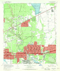
1967 Map of Jacinto City
USGS Topo · Published 1970About this map
Industrial expansion and residential growth define this eastern Harris County landscape during the late 1960s. Jacinto City and Galena Park stand as established hubs near the heavy industry of the ship channel, while the red-tinted footprints of Channelview, Cloverleaf, and Beaumont Place show the rapid suburbanization of the era. The mapping of the Sheldon Wildlife Management Area and Sheldon Reservoir to the north contrasts sharply with the oil-rich terrain of Oates Prairie and the various Oil Wells scattered throughout the west.
Find a feature on this map
56 named features on this map. Tap any name to fly to it.
Don’t see what you’re looking for? This feature index may not catch every label — zoom into the map to look around manually.
Map Details
Editions of this 1967 Jacinto City Map
This is the sole edition of this map. No revisions or reprints were ever made.
Other maps of this area

1915 · Park Place
USGS Topo · 1:24,000

1915 · Deepwater
USGS Topo · 1:24,000

1916 · Burnett Bay
USGS Topo · 1:24,000

1916 · Crosby
USGS Topo · 1:24,000

1916 · Settegast
USGS Topo · 1:24,000

1916 · Fauna
USGS Topo · 1:24,000

1916 · Harmaston
USGS Topo · 1:24,000

1916 · Humble
USGS Topo · 1:24,000

1916 · La Porte
USGS Topo · 1:24,000

1919 · Deepwater
USGS Topo · 1:31,680