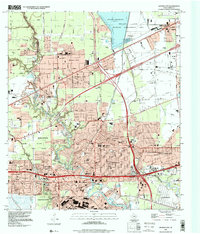
1995 Map of Jacinto City
USGS Topo · Published 2000About this map
Jacinto City and the surrounding industrial and residential landscape of eastern Harris County are meticulously documented in this mid-1990s survey. The area is defined by the winding course of Greens Bayou and Carpenters Bayou, which support the intensive development of Jacintoport and nearby shipping facilities. Extensive pipeline networks and sewage disposal systems underscore the infrastructure required for the region's massive industrial growth.
Find a feature on this map
75 named features on this map. Tap any name to fly to it.
Don’t see what you’re looking for? This feature index may not catch every label — zoom into the map to look around manually.
Map Details
Editions of this 1995 Jacinto City Map
This is the sole edition of this map. No revisions or reprints were ever made.
Other maps of this area

1915 · Park Place
USGS Topo · 1:24,000

1915 · Deepwater
USGS Topo · 1:24,000

1916 · Burnett Bay
USGS Topo · 1:24,000

1916 · Crosby
USGS Topo · 1:24,000

1916 · Settegast
USGS Topo · 1:24,000

1916 · Fauna
USGS Topo · 1:24,000

1916 · Harmaston
USGS Topo · 1:24,000

1916 · Humble
USGS Topo · 1:24,000

1916 · La Porte
USGS Topo · 1:24,000

1919 · Deepwater
USGS Topo · 1:31,680