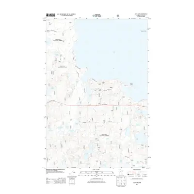
2013 Map of Jack Lake
USGS Topo · Published 2013About this map
Chippewa National Forest encompasses the vast majority of this landscape in Cass County, where the southern reaches of Leech Lake meet a complex network of smaller basins and wetlands. The map details a transition from the open waters around Pelican Island and Rogers Point to the interior woods, where numerous bodies of water like Wabegon Lake, Jack Lake, and the Hanson Lakes dominate the topography. Cultural markers are concentrated along the winding forest routes and trails, including the Medicine Rite Cem near the northwestern shore and Hope Cem further south. The hydrography is particularly intricate near the Bag Lake Impoundment, which feeds into a series of smaller ponds and creeks, such as Whipholt Creek, illustrating the natural drainage patterns that have long defined the recreation and ecology of this Minnesota lake country.
Find a feature on this map
97 named features on this map. Tap any name to fly to it.
Don’t see what you’re looking for? This feature index may not catch every label — zoom into the map to look around manually.
Map Details
Editions of this 2013 Jack Lake Map
This is the sole edition of this map. No revisions or reprints were ever made.
Other maps of this area

1953 · Brainerd
USGS Topo · 1:250,000

1954 · Bemidji
USGS Topo · 1:250,000

1957 · Brainerd
USGS Topo · 1:250,000

1957 · Bemidji
USGS Topo · 1:250,000

1958 · Bemidji
USGS Topo · 1:250,000

1958 · Brainerd
USGS Topo · 1:250,000

1965 · Brainerd
USGS Topo · 1:250,000

1970 · Hackensack
USGS Topo · 1:24,000

1970 · Webb Lake
USGS Topo · 1:24,000

1970 · Woman Lake
USGS Topo · 1:24,000