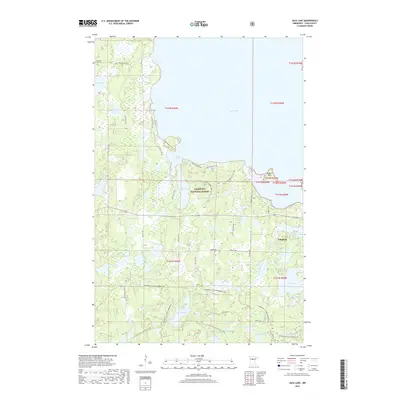
2019 Map of Jack Lake
USGS Topo · Published 2019About this map
Chippewa National Forest dominates this landscape along the southern and western shores of Leech Lake, where numerous bays and points define the shoreline. The settlement of Whipholt sits near the eastern edge of the map, serving as a gateway to the intricate network of water bodies such as Jack Lake, Shell Lake, and Pine Lake. This area of Cass County is characterized by its glacial topography, with dozens of small lakes and marshes connected by seasonal drainage and local roads like Rocky Point Rd NW.
Find a feature on this map
51 named features on this map. Tap any name to fly to it.
Don’t see what you’re looking for? This feature index may not catch every label — zoom into the map to look around manually.
Map Details
Editions of this 2019 Jack Lake Map
This is the sole edition of this map. No revisions or reprints were ever made.
Other maps of this area

1953 · Brainerd
USGS Topo · 1:250,000

1954 · Bemidji
USGS Topo · 1:250,000

1957 · Brainerd
USGS Topo · 1:250,000

1957 · Bemidji
USGS Topo · 1:250,000

1958 · Bemidji
USGS Topo · 1:250,000

1958 · Brainerd
USGS Topo · 1:250,000

1965 · Brainerd
USGS Topo · 1:250,000

1970 · Hackensack
USGS Topo · 1:24,000

1970 · Webb Lake
USGS Topo · 1:24,000

1970 · Woman Lake
USGS Topo · 1:24,000