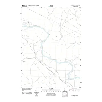
2010 Map of Jackass Butte
USGS Topo · Published 2010About this map
The Snake River winds through this high desert landscape, serving as the primary geological and economic artery for the region. The river's influence is evident in the presence of the Grand View Irrigation District Canal, which draws water to support the arid terrain. Historical travel patterns are etched into the land via the Emigrant Trl, which passes near the prominent basalt formations of Jackass Butte and Black Butte. Local ranching operations like the Bonus Cove Ranch appear along the river's edge, while various seasonal watercourses such as Cloudburst Wash and McKeeth Wash indicate the dramatic drainage patterns of the Owyhee and Ada County borderlands. The network of rural roads, including Big Foot Bar Rd and Geo Bennett Rd, provides access to the river's bars and the surrounding sagebrush steppe.
Find a feature on this map
23 named features on this map. Tap any name to fly to it.
Don’t see what you’re looking for? This feature index may not catch every label — zoom into the map to look around manually.
Map Details
Editions of this 2010 Jackass Butte Map
This is the sole edition of this map. No revisions or reprints were ever made.
Other maps of this area

1892 · Bisuka
USGS Topo · 1:125,000

1894 · Bisuka
USGS Topo · 1:125,000

1947 · Grand View
USGS Topo · 1:62,500

1947 · Grand View
USGS Topo · 1:24,000

1947 · Jackass Butte
USGS Topo · 1:24,000

1947 · Wild Horse Butte
USGS Topo · 1:24,000

1947 · Vinson Wash
USGS Topo · 1:24,000

1947 · Dorsey Butte
USGS Topo · 1:24,000

1948 · Castle Butte
USGS Topo · 1:24,000

1948 · Vinson Wash
USGS Topo · 1:24,000