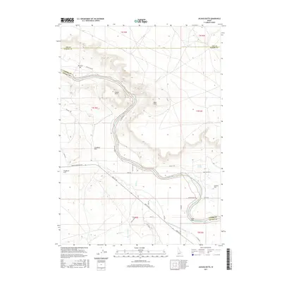
2017 Map of Jackass Butte
USGS Topo · Published 2017About this map
Jackass Butte and Black Butte dominate the high ground above the winding Snake River in this arid landscape where the borders of Ada, Elmore, and Owyhee counties converge. This 2017 study illustrates the modern geography of the Snake River valley, showing the persistent influence of water and transport on the local terrain. Long-established routes like the Emigrant Trl and Big Foot Bar Rd track the river's edge, connecting points like Big Foot Bar and Chattin Flat. The development of agriculture and infrastructure is evidenced by the Grand View Irrigation District Canal and more modern additions like Missile Base Rd. Numerous washes and gulches, including Cloudburst Wash and Vinson Wash, score the landscape, while Rabbit Springs provides a rare point of named hydrology away from the main river corridor.
Find a feature on this map
41 named features on this map. Tap any name to fly to it.
Don’t see what you’re looking for? This feature index may not catch every label — zoom into the map to look around manually.
Map Details
Editions of this 2017 Jackass Butte Map
This is the sole edition of this map. No revisions or reprints were ever made.
Other maps of this area

1892 · Bisuka
USGS Topo · 1:125,000

1894 · Bisuka
USGS Topo · 1:125,000

1947 · Grand View
USGS Topo · 1:62,500

1947 · Grand View
USGS Topo · 1:24,000

1947 · Jackass Butte
USGS Topo · 1:24,000

1947 · Wild Horse Butte
USGS Topo · 1:24,000

1947 · Vinson Wash
USGS Topo · 1:24,000

1947 · Dorsey Butte
USGS Topo · 1:24,000

1948 · Castle Butte
USGS Topo · 1:24,000

1948 · Vinson Wash
USGS Topo · 1:24,000