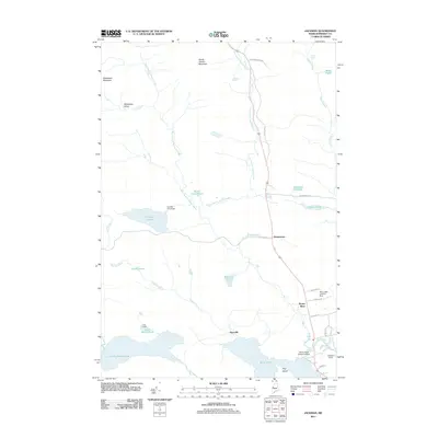
2011 Map of Jackman
USGS Topo · Published 2011About this map
Dennistown and the nearby settlement of Moose River anchor this 2011 survey of the Maine north woods, a landscape defined by an intricate network of waterways and specialized aviation infrastructure. The region's connection to the wilderness is underscored by the presence of the Sky Lodge Landing Strip, Newton Field, and the Moose River Seaplane Base, highlighting the importance of bush flying in accessing this remote part of Somerset County.
Find a feature on this map
39 named features on this map. Tap any name to fly to it.
Don’t see what you’re looking for? This feature index may not catch every label — zoom into the map to look around manually.
Map Details
Editions of this 2011 Jackman Map
This is the sole edition of this map. No revisions or reprints were ever made.
Other maps of this area

1922 · Long Pond
USGS Topo · 1:62,500

1923 · Attean
USGS Topo · 1:62,500

1924 · Long Pond
USGS Topo · 1:62,500

1925 · Attean
USGS Topo · 1:62,500

1927 · Sandy Bay
USGS Topo · 1:48,000

1930 · Sandy Bay
USGS Topo · 1:62,500

1944 · Long Pond
USGS Topo · 1:62,500

1944 · Sandy Bay
USGS Topo · 1:62,500

1949 · Jackman
USGS Topo · 1:250,000

1950 · Attean
USGS Topo · 1:50,000
Featured Places
- Jackman, ME
- Moose River, ME
- Dennistown Plantation, ME
- Dyerville, Dennistown Plantation
- Attean Township, ME