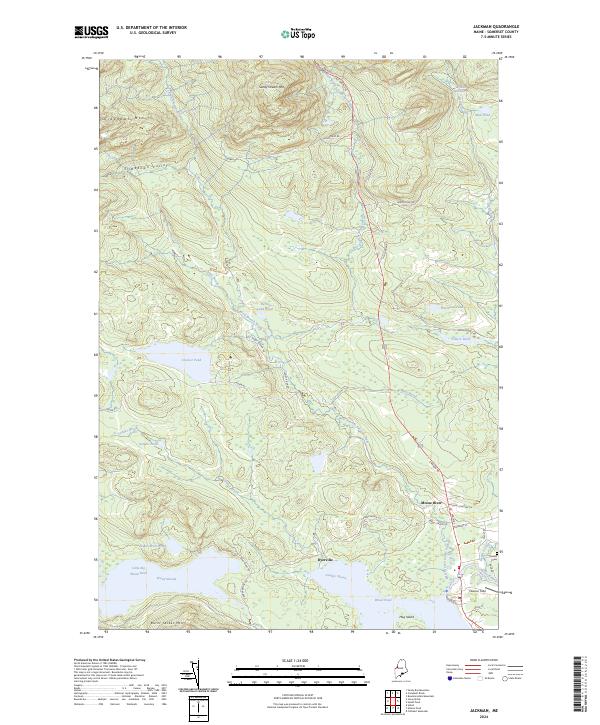
2024 Map of Jackman
USGS Topo · Published 2024About this map
Moose River and the small settlements of Dyerville and Holden anchor this portion of Somerset County, where the landscape is defined by an intricate network of waterways and timbered ridges. The confluence of the West Branch Sandy Stream and East Branch Sandy Stream feeds into the larger river systems, supporting a history of logging and outdoor recreation. The map captures local landmarks like Newton Field and the Holden Cem, which serve as points of interest for genealogists and local historians. North of the larger bodies of water, including Wood Pond and Little Big Wood Pond, the terrain rises toward Sandy Stream Mtn and Slidedown Mtn. This area is crisscrossed by established routes such as the Old Canada Rd and the Alt Main Trl, reflecting the historical importance of this corridor for travel between the Maine interior and the northern border.
Find a feature on this map
49 named features on this map. Tap any name to fly to it.
Don’t see what you’re looking for? This feature index may not catch every label — zoom into the map to look around manually.
Map Details
Editions of this 2024 Jackman Map
This is the sole edition of this map. No revisions or reprints were ever made.
Other maps of this area

1922 · Long Pond
USGS Topo · 1:62,500

1923 · Attean
USGS Topo · 1:62,500

1924 · Long Pond
USGS Topo · 1:62,500

1925 · Attean
USGS Topo · 1:62,500

1927 · Sandy Bay
USGS Topo · 1:48,000

1930 · Sandy Bay
USGS Topo · 1:62,500

1944 · Long Pond
USGS Topo · 1:62,500

1944 · Sandy Bay
USGS Topo · 1:62,500

1949 · Jackman
USGS Topo · 1:250,000

1950 · Attean
USGS Topo · 1:50,000