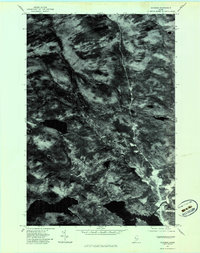
1977 Map of Jackman
USGS Topo · Published 1983About this map
Jackman and the nearby settlement of Dyerville sit at the center of this orthophotographic study, which utilizes aerial imagery taken in late October 1977. The landscape is defined by its complex drainage network, where the Moose River winds through the southern portion of the quadrangle. Significant watercourses like Sandy Stream and the East Branch carve through the heavily forested terrain, revealing the natural corridors that have historically dictated movement and settlement in this part of Somerset County. By using rectified photoimagery instead of traditional topographic lines, this map provides a clear view of the dense vegetation and the precise footprint of human activity at Moose Pond and along the local road networks during the late 1970s.
Find a feature on this map
7 named features on this map. Tap any name to fly to it.
Don’t see what you’re looking for? This feature index may not catch every label — zoom into the map to look around manually.
Map Details
Editions of this 1977 Jackman Map
This is the sole edition of this map. No revisions or reprints were ever made.
Other maps of this area

1922 · Long Pond
USGS Topo · 1:62,500

1923 · Attean
USGS Topo · 1:62,500

1924 · Long Pond
USGS Topo · 1:62,500

1925 · Attean
USGS Topo · 1:62,500

1927 · Sandy Bay
USGS Topo · 1:48,000

1930 · Sandy Bay
USGS Topo · 1:62,500

1944 · Long Pond
USGS Topo · 1:62,500

1944 · Sandy Bay
USGS Topo · 1:62,500

1949 · Jackman
USGS Topo · 1:250,000

1950 · Attean
USGS Topo · 1:50,000
Featured Places
- Jackman, ME
- Moose River, ME
- Dennistown Plantation, ME
- Attean Township, ME
- Bald Mountain Township T4 R3, ME