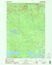
1989 Map of Jackman
USGS Topo · Published 1989About this map
The Moose River winds through the heart of this North Woods landscape, connecting the water bodies of Wood Pond and Little Big Wood Pond near the regional center of Jackman. This late 1980s provisional survey illustrates a transition between wilderness and industry, where remote settlements like Dennistown and Dyerville sit among vast timberlands and the headwaters of the West Branch and East Branch streams.
Find a feature on this map
41 named features on this map. Tap any name to fly to it.
Don’t see what you’re looking for? This feature index may not catch every label — zoom into the map to look around manually.
Map Details
Editions of this 1989 Jackman Map
This is the sole edition of this map. No revisions or reprints were ever made.
Other maps of this area

1922 · Long Pond
USGS Topo · 1:62,500

1923 · Attean
USGS Topo · 1:62,500

1924 · Long Pond
USGS Topo · 1:62,500

1925 · Attean
USGS Topo · 1:62,500

1927 · Sandy Bay
USGS Topo · 1:48,000

1930 · Sandy Bay
USGS Topo · 1:62,500

1944 · Long Pond
USGS Topo · 1:62,500

1944 · Sandy Bay
USGS Topo · 1:62,500

1949 · Jackman
USGS Topo · 1:250,000

1950 · Attean
USGS Topo · 1:50,000
Featured Places
- Jackman, ME
- Moose River, ME
- Dennistown Plantation, ME
- Attean Township, ME
- Bald Mountain Township T4 R3, ME