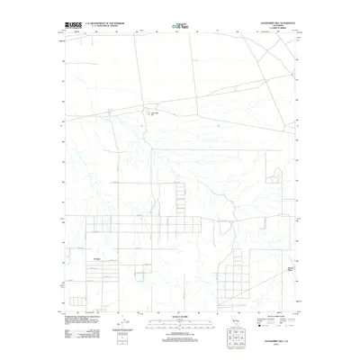
2012 Map of Jackrabbit Hill
USGS Topo · Published 2012About this map
Hi Vista stands as a primary settlement node in this high-desert region of San Bernardino County, defined by a rigid grid of residential and agricultural avenues. The landscape is characterized by intermittent drainage patterns that flow southward from the slopes surrounding Jackrabbit Hill. To the southeast, the named location of Houze Place and the Rancho Buena Vis corridor suggest localized history and land holdings within this arid environment. The surveyor's work in 2012 shows a meticulous road network, including arterial routes like Avenue B and Avenue E, which provide access to a dispersed community of homesteads and small-scale operations. The topography is subtle but significant, with the terrain slowly descending toward the Antelope Valley floor, intersected by seasonal washes and a web of north-south streets such as 230th St E.
Find a feature on this map
27 named features on this map. Tap any name to fly to it.
Don’t see what you’re looking for? This feature index may not catch every label — zoom into the map to look around manually.
Map Details
Editions of this 2012 Jackrabbit Hill Map
This is the sole edition of this map. No revisions or reprints were ever made.
Other maps of this area

1931 · Adobe
USGS Topo · 1:24,000

1931 · Hi Vista
USGS Topo · 1:24,000

1934 · Adobe
USGS Topo · 1:24,000

1935 · Hi Vista
USGS Topo · 1:24,000

1937 · Shadow Mountains
USGS Topo · 1:48,000

1937 · Kramer
USGS Topo · 1:48,000

1937 · Rogers Lake
USGS Topo · 1:48,000

1942 · Kramer
USGS Topo · 1:62,500

1942 · Shadow Mountains
USGS Topo · 1:62,500

1942 · Rogers Lake
USGS Topo · 1:62,500