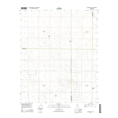
2015 Map of Jackrabbit Hill
USGS Topo · Published 2015About this map
Jackrabbit Hill rises as a prominent landmark in this desert landscape where the borders of Kern, Los Angeles, and San Bernardino counties converge. The terrain is defined by the arid expanse of the Mojave Desert and the flat reaches of the El Mirage Valley. Human activity is primarily traced through a rigid grid of desert roads, including E Avenue B and E Avenue C, which cross the open landscape. Near the southeastern corner of the map, the settlement of Houze Place appears alongside Pineridge Rd, representing a pocket of habitation amidst the vast alluvial plains. This 2015 survey provides a clear view of the sparse rural development and the intersection of multiple county jurisdictions in this high desert region.
Find a feature on this map
21 named features on this map. Tap any name to fly to it.
Don’t see what you’re looking for? This feature index may not catch every label — zoom into the map to look around manually.
Map Details
Editions of this 2015 Jackrabbit Hill Map
This is the sole edition of this map. No revisions or reprints were ever made.
Other maps of this area

1931 · Adobe
USGS Topo · 1:24,000

1931 · Hi Vista
USGS Topo · 1:24,000

1934 · Adobe
USGS Topo · 1:24,000

1935 · Hi Vista
USGS Topo · 1:24,000

1937 · Shadow Mountains
USGS Topo · 1:48,000

1937 · Kramer
USGS Topo · 1:48,000

1937 · Rogers Lake
USGS Topo · 1:48,000

1942 · Kramer
USGS Topo · 1:62,500

1942 · Shadow Mountains
USGS Topo · 1:62,500

1942 · Rogers Lake
USGS Topo · 1:62,500