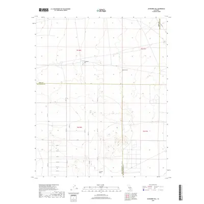
2018 Map of Jackrabbit Hill
USGS Topo · Published 2018About this map
Jackrabbit Hill rises as a prominent landmark in this section of the High Desert, situated where the borders of Kern, Los Angeles, and San Bernardino counties converge. The landscape is defined by the open expanse of the Mojave Desert, transitioning into the El Mirage Valley to the south. This 2018 survey reveals a sparse but rigid grid of desert roads, including Ave A and a series of alphabetical and numbered routes like 220th St E and E Ave D. The presence of Mars Blvd in the northeast corner suggests the region's connection to aerospace or military testing facilities often found in this arid corridor. The map effectively captures the intersection of three major California counties and the persistent, geometric human footprint upon the vast alluvial plains.
Find a feature on this map
28 named features on this map. Tap any name to fly to it.
Don’t see what you’re looking for? This feature index may not catch every label — zoom into the map to look around manually.
Map Details
Editions of this 2018 Jackrabbit Hill Map
This is the sole edition of this map. No revisions or reprints were ever made.
Other maps of this area

1931 · Adobe
USGS Topo · 1:24,000

1931 · Hi Vista
USGS Topo · 1:24,000

1934 · Adobe
USGS Topo · 1:24,000

1935 · Hi Vista
USGS Topo · 1:24,000

1937 · Shadow Mountains
USGS Topo · 1:48,000

1937 · Kramer
USGS Topo · 1:48,000

1937 · Rogers Lake
USGS Topo · 1:48,000

1942 · Kramer
USGS Topo · 1:62,500

1942 · Shadow Mountains
USGS Topo · 1:62,500

1942 · Rogers Lake
USGS Topo · 1:62,500