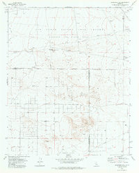
1973 Map of Jackrabbit Hill
USGS Topo · Published 1977About this map
The Air Force Flight Test Center Edwards Air Force Base dominates the northern landscape of this High Desert region, defined by a stark network of military and infrastructure development. Within the Military Reservation, specialized installations such as an Observation Tower, multiple Tracking Station sites, and various Target markers illustrate the mid-century aerospace testing environment. Below the Kern County and Los Angeles County line, the terrain transitions into the El Mirage Valley, where a rigid grid of roads including East Avenue B and 260th St sections the land.
Find a feature on this map
30 named features on this map. Tap any name to fly to it.
Don’t see what you’re looking for? This feature index may not catch every label — zoom into the map to look around manually.
Map Details
Editions of this 1973 Jackrabbit Hill Map
This is the sole edition of this map. No revisions or reprints were ever made.
Other maps of this area

1931 · Adobe
USGS Topo · 1:24,000

1931 · Hi Vista
USGS Topo · 1:24,000

1934 · Adobe
USGS Topo · 1:24,000

1935 · Hi Vista
USGS Topo · 1:24,000

1937 · Shadow Mountains
USGS Topo · 1:48,000

1937 · Kramer
USGS Topo · 1:48,000

1937 · Rogers Lake
USGS Topo · 1:48,000

1942 · Kramer
USGS Topo · 1:62,500

1942 · Shadow Mountains
USGS Topo · 1:62,500

1942 · Rogers Lake
USGS Topo · 1:62,500