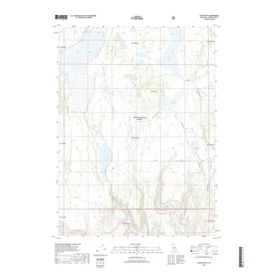
2018 Map of Jacks Butte
USGS Topo · Published 2018About this map
The high plateau of Modoc National Forest dominates this landscape, where the volcanic topography of Jacks Butte rises above a complex network of seasonal wetlands and water storage sites. Modern hydrologic management is evident through features like Antelope Reservoir and Mapes Reservoir, which dot the arid terrain of Antelope Plains. The map records a carefully managed environment where drainage systems like Witcher Creek and Clover Swale Creek are vital for the surrounding ecosystem. This 2018 survey detail provides a clear look at the intersection of public land management and high-desert geography. Cattle ranching and land use history are represented by scattered watering points such as Jacks Butte Tank, Essex Tank, and Little Porcupine Tank, alongside naturally occurring springs like Essex Spring and Pine Spring. The presence of broad basins like Fairchild Swamp and Dobe Swale illustrates the slow-draining character of the local geology.
Find a feature on this map
29 named features on this map. Tap any name to fly to it.
Don’t see what you’re looking for? This feature index may not catch every label — zoom into the map to look around manually.
Map Details
Editions of this 2018 Jacks Butte Map
This is the sole edition of this map. No revisions or reprints were ever made.
Other maps of this area

1886 · Alturas
USGS Topo · 1:250,000

1892 · Alturas
USGS Topo · 1:250,000

1954 · Alturas
USGS Topo · 1:250,000

1958 · Alturas
USGS Topo · 1:250,000

1961 · Canby
USGS Topo · 1:62,500

1961 · Alturas
USGS Topo · 1:62,500

1962 · Alturas
USGS Topo · 1:250,000

1962 · Big Sage Reservoir
USGS Topo · 1:62,500

1962 · Jacks Butte
USGS Topo · 1:62,500

1965 · Alturas
USGS Topo · 1:250,000