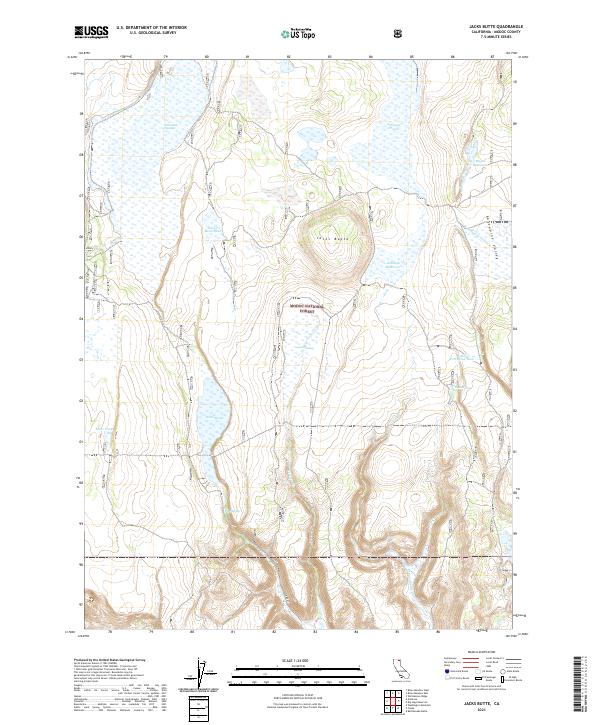
2021 Map of Jacks Butte
USGS Topo · Published 2021About this map
Modoc National Forest encompasses the landscape of this Northeastern California survey, dominated by a series of volcanic features and seasonal wetlands. The namesake Jacks Butte rises as a central landmark, surrounded by significant basins including Jacks Swamp and Fairchild Swamp. Water management is a defining characteristic of this arid terrain, with numerous man-made and natural sources scattered throughout, such as the Antelope Reservoir, Mapes Reservoir, and various livestock watering points like Jacks Butte Tank and Little Porcupine Tank. These features suggest a landscape traditionally utilized for seasonal grazing and wildlife management. High-desert drainage patterns are visible through features like Dobe Swale and the descent into Clover Swale Cyn, while historic routes like Co RD 67 provide the primary access through the Antelope Plains.
Find a feature on this map
25 named features on this map. Tap any name to fly to it.
Don’t see what you’re looking for? This feature index may not catch every label — zoom into the map to look around manually.
Map Details
Editions of this 2021 Jacks Butte Map
This is the sole edition of this map. No revisions or reprints were ever made.
Other maps of this area

1886 · Alturas
USGS Topo · 1:250,000

1892 · Alturas
USGS Topo · 1:250,000

1954 · Alturas
USGS Topo · 1:250,000

1958 · Alturas
USGS Topo · 1:250,000

1961 · Canby
USGS Topo · 1:62,500

1961 · Alturas
USGS Topo · 1:62,500

1962 · Alturas
USGS Topo · 1:250,000

1962 · Big Sage Reservoir
USGS Topo · 1:62,500

1962 · Jacks Butte
USGS Topo · 1:62,500

1965 · Alturas
USGS Topo · 1:250,000