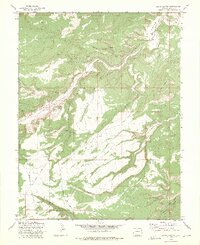
1972 Map of Jacks Canyon
USGS Topo · Published 1975About this map
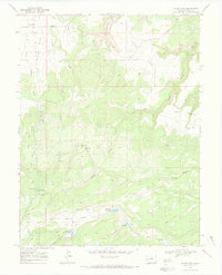
Unaweep Canyon and its dramatic drainage systems dominate this 1970s survey of Mesa County. The landscape is defined by deep incisions like Nancy Hanks Gulch and Farmers Canyon, which carve through the high country towards the basin of East Unaweep Creek. Human activity is sparse and primarily extractive, marked by several Mines and a Quarry situated along the slopes and gulches. The southwestern portion of the map is occupied by the Uncompahgre National Forest, where a network of jeep trails and pack trails provides the only access into the high-elevation terrain. This map serves as an excellent reference for the mid-century industrial footprint and the topographic layout of the southern Uncompahgre Plateau before more modern developments, including names like Gibbler Mountain and Rocky Pitch Gulch.
Find a feature on this map
20 named features on this map. Tap any name to fly to it.
Don’t see what you’re looking for? This feature index may not catch every label — zoom into the map to look around manually.
Map Details
Editions of this 1972 Jacks Canyon Map
2 editions found
Other maps of this area

1956 · Moab
USGS Topo · 1:250,000

1959 · Moab
USGS Topo · 1:250,000

1960 · Moab
USGS Topo · 1:250,000

1962 · Moab
USGS Topo · 1:250,000

1964 · Moab
USGS Topo · 1:250,000

1965 · Moab
USGS Topo · 1:250,000
1969 · Whitewater
USGS Topo · 1:24,000
1969 · Triangle Mesa
USGS Topo · 1:24,000
1969 · Glade Park
USGS Topo · 1:24,000
1969 · Island Mesa
USGS Topo · 1:24,000