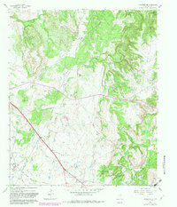
1961 Map of Jacksboro NE
USGS Topo · Published 1982About this map
The Rusmag Oil Field dominates the southern landscape of this Texas quadrangle, where a network of pipelines and gravel roads service numerous oil wells and wells across the plains. This industrial footprint is juxtaposed against the older rural markers of Jack County, notably the Carroll Creek Cem situated near the waters of Carroll Creek. To the northeast, the terrain shifts as the land descends toward the controlled waters of Lake Bridgeport, where the shoreline is subject to inundation levels up to 850 feet.
Find a feature on this map
15 named features on this map. Tap any name to fly to it.
Don’t see what you’re looking for? This feature index may not catch every label — zoom into the map to look around manually.
Map Details
Editions of this 1961 Jacksboro NE Map
2 editions found
Other maps of this area

1954 · Sherman
USGS Topo · 1:250,000

1954 · Wichita Falls
USGS Topo · 1:250,000

1958 · Wichita Falls
USGS Topo · 1:250,000

1958 · Sherman
USGS Topo · 1:250,000

1960 · Gibtown
USGS Topo · 1:24,000

1960 · Wizard Wells
USGS Topo · 1:24,000

1960 · Jacksboro
USGS Topo · 1:24,000
1961 · Bartons Chapel
USGS Topo · 1:24,000
1961 · Perrin
USGS Topo · 1:24,000

1961 · Jacksboro NE
USGS Topo · 1:24,000