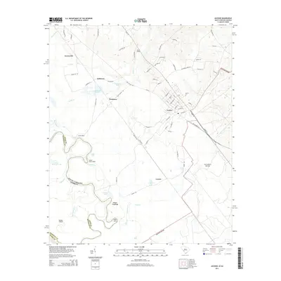
2014 Map of Jackson
USGS Topo · Published 2014About this map
The Savanna River forms a dynamic boundary between South Carolina and Georgia, anchoring a landscape shaped by both natural waterways and modern infrastructure. The town of Jackson serves as the primary population center, featuring a grid of residential streets and the Jackson Cem. To the northwest, the settlements of Kathwood and Hankinson sit near the Kathwood Lakes and Wasteway Pond, illustrating the area's transition from agricultural land to managed water systems. The river's winding path is marked by distinctive features such as Silver Bluff and the prehistoric Rhodes Mound, highlighting a long history of human activity along the shoreline. Further south, Grays Landing and the E Reservoir near Cowden reveal the continued importance of the river corridor for both transport and water management in the early twenty-first century.
Find a feature on this map
78 named features on this map. Tap any name to fly to it.
Don’t see what you’re looking for? This feature index may not catch every label — zoom into the map to look around manually.
Map Details
Editions of this 2014 Jackson Map
This is the sole edition of this map. No revisions or reprints were ever made.
Other maps of this area

1920 · Ellenton
USGS Topo · 1:48,000

1920 · Greens Cut
USGS Topo · 1:62,500

1920 · Talatha
USGS Topo · 1:48,000

1921 · Augusta
USGS Topo · 1:62,500

1921 · Talatha
USGS Topo · 1:62,500

1921 · Ellenton
USGS Topo · 1:62,500

1943 · Greens Cut
USGS Topo · 1:62,500

1943 · Augusta East
USGS Topo · 1:125,000

1943 · Talatha
USGS Topo · 1:62,500

1943 · Augusta
USGS Topo · 1:62,500