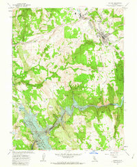
1962 Map of Jackson
USGS Topo · Published 1963About this map
The gold-bearing hills of the Mother Lode dominate this early 1960s study, centered on Jackson and the extensive network of historic mines surrounding it. Large-scale operations such as the Kennedy Mine and Argonaut Mine are clearly marked north of the city, alongside smaller workings like the Zeile Mine and South Jackson Mine. The Amador Central railroad serves the industrial hub of Martell, while the southern portion of the map is defined by the deep waters of Pardee Reservoir behind the Pardee Dam. This geography illustrates the transition from the era of hard-rock mining to a landscape managed for water storage and recreation, as seen at the Pardee Reservoir Recreation Area. Small settlements like Scottsville and Jackson Gate remain as reminders of the region's dense late-19th-century settlement patterns.
Find a feature on this map
85 named features on this map. Tap any name to fly to it.
Don’t see what you’re looking for? This feature index may not catch every label — zoom into the map to look around manually.
Map Details
Editions of this 1962 Jackson Map
3 editions found
Other maps of this area

1889 · Jackson
USGS Topo · 1:125,000

1892 · Jackson
USGS Topo · 1:125,000

1897 · Jackson
USGS Topo · 1:125,000

1902 · Jackson
USGS Topo · 1:125,000

1941 · Sutter Creek
USGS Topo · 1:62,500

1944 · Valley Springs
USGS Topo · 1:62,500

1944 · Sutter Creek
USGS Topo · 1:62,500

1945 · San Andreas
USGS Topo · 1:62,500

1947 · San Andreas
USGS Topo · 1:62,500

1947 · Sacramento
USGS Topo · 1:250,000