1978 Map of Jackson
USGS Topo · Published 1989About this map
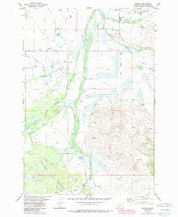
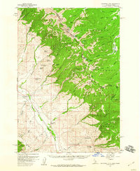
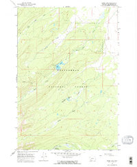
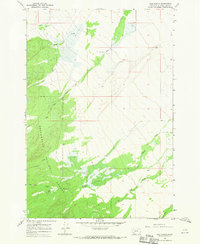
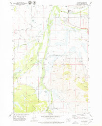
Jackson anchors this portion of the Big Hole Valley, serving as a hub for the surrounding ranching and thermal spring landscape in the late 1970s and 1980s. The town's proximity to Warm Springs and the Jardine Hot Spring underscores the geothermal character of the region, where water resources are carefully managed through an extensive network of ditches. To the east, Patterson Springs and the rising elevation of Davis Bench overlook the valley floor, while the Big Hole River winds northward through a broad wetland corridor. The southern portion of the map transitions into the Beaverhead National Forest, where the topography steepens significantly at Ski Hill and Bailey Gulch. This survey captures a mix of recreation and industry, from the Landing Strip near town to various Gravel Pit operations and well-defined routes like Miner Lake Road and the Sawmill Trail that reach into the high country.
Find a feature on this map
21 named features on this map. Tap any name to fly to it.
Don’t see what you’re looking for? This feature index may not catch every label — zoom into the map to look around manually.
Map Details
Editions of this 1978 Jackson Map
2 editions found
Other maps of this area

1955 · Dillon
USGS Topo · 1:250,000
1956 · Goldstone Mtn
USGS Topo · 1:62,500

1957 · Dillon
USGS Topo · 1:250,000

1958 · Dillon
USGS Topo · 1:250,000

1962 · Dillon
USGS Topo · 1:250,000

1965 · Dillon
USGS Topo · 1:250,000
1966 · Miner Lake
USGS Topo · 1:24,000
1966 · Ajax Ranch
USGS Topo · 1:24,000
1978 · Jackson
USGS Topo · 1:24,000
1978 · Butch Hill
USGS Topo · 1:24,000