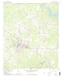
1964 Map of Jackson
USGS Topo · Published 1986About this map
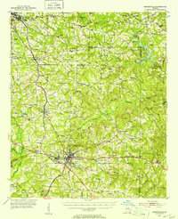
Jackson serves as the central hub of this mid-century survey, revealing a landscape defined by the Southern railroad line and a transition toward modernized infrastructure. To the south, Indian Springs State Park and the Indian Springs Campground highlight a longstanding history of recreation near Flovilla, while the northern reaches show the development of Jackson Lake and the scattered rural communities of Stark and Macedonia Ch. Educational and civic life is anchored by Henderson High Sch and a local Hospital, while the era's social culture is marked by the Drive-in Theater west of town. The map documents numerous family landmarks and resting places, such as the Robert Grier Home, Etheredge Cem, and Watkins Cem, providing a detailed record of the cultural geography of Butts County before further modern expansion.
Find a feature on this map
43 named features on this map. Tap any name to fly to it.
Don’t see what you’re looking for? This feature index may not catch every label — zoom into the map to look around manually.
Map Details
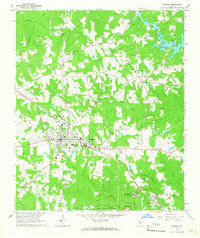
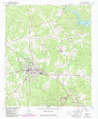
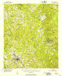
Editions of this 1964 Jackson Map
3 editions found
Other maps of this area
1951 · Forsyth
USGS Topo · 1:62,500
1951 · Barnesville
USGS Topo · 1:62,500

1953 · Atlanta
USGS Topo · 1:250,000

1953 · Athens
USGS Topo · 1:250,000

1957 · Atlanta
USGS Topo · 1:250,000

1958 · Athens
USGS Topo · 1:250,000

1958 · Atlanta
USGS Topo · 1:250,000

1959 · Athens
USGS Topo · 1:250,000

1963 · Athens
USGS Topo · 1:250,000

1964 · Lloyd Shoals Dam
USGS Topo · 1:24,000