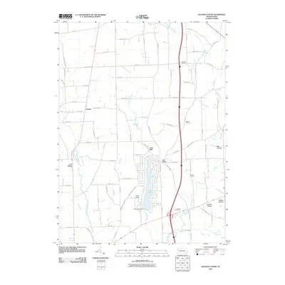
2010 Map of Jackson Center
USGS Topo · Published 2010About this map
Lake Latonka dominates the central landscape of this western Pennsylvania region, created by the Lake Latonka Dam along Cool Spring Creek. The map documents a predominantly rural patchwork of Fairview Township, punctuated by historical crossroads settlements such as North Mills and Five Points. For genealogists, the survey identifies several significant burial sites, including Centenary Cemetery, Bethany Cemetery, and the Old Cool Spring Cemetery, which sit among a network of family-named roads like McCartney Rd and Steckler Rd.
Find a feature on this map
82 named features on this map. Tap any name to fly to it.
Don’t see what you’re looking for? This feature index may not catch every label — zoom into the map to look around manually.
Map Details
Editions of this 2010 Jackson Center Map
This is the sole edition of this map. No revisions or reprints were ever made.
Other maps of this area

1905 · Neshannock
USGS Topo · 1:62,500

1907 · Neshannock
USGS Topo · 1:62,500

1908 · Shenango
USGS Topo · 1:62,500

1911 · Stoneboro
USGS Topo · 1:62,500

1913 · Stoneboro
USGS Topo · 1:62,500

1913 · Mercer
USGS Topo · 1:62,500

1939 · Mercer
USGS Topo · 1:62,500

1943 · Mercer
USGS Topo · 1:62,500

1943 · Stoneboro
USGS Topo · 1:62,500

1950 · Cleveland
USGS Topo · 1:250,000
Featured Places
- Fairview Township, PA
- New Vernon Township, PA
- Jackson Center, PA
- Perry Township, PA
- Jackson Township, PA