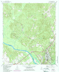
1978 Map of Jackson
USGS Topo · Published 1986About this map
The Tombigbee River serves as the primary artery and county line between Clarke and Washington counties in this late 1970s topographic study. The city of Jackson is the dominant settlement, showing a grid of streets and a Southern railroad line running through its eastern side. The industrial and utility infrastructure near the river includes a Pumping Station and Waterworks, which supported the region's mid-century growth. To the west, the landscape is defined by the Upper State Game Sanctuary and a series of rural landmarks like Mays Crossroads and Leroy.
Find a feature on this map
39 named features on this map. Tap any name to fly to it.
Don’t see what you’re looking for? This feature index may not catch every label — zoom into the map to look around manually.
Map Details
Editions of this 1978 Jackson Map
2 editions found

Other maps of this area

1943 · Choctaw Bluff
USGS Topo · 1:62,500

1943 · McIntosh
USGS Topo · 1:62,500

1944 · McIntosh
USGS Topo · 1:62,500

1946 · Choctaw Bluff
USGS Topo · 1:62,500

1953 · Andalusia
USGS Topo · 1:250,000

1953 · Hattiesburg
USGS Topo · 1:250,000

1957 · Andalusia
USGS Topo · 1:250,000

1958 · Hattiesburg
USGS Topo · 1:250,000

1972 · Tattlersville
USGS Topo · 1:24,000

1972 · St. Stephens
USGS Topo · 1:24,000