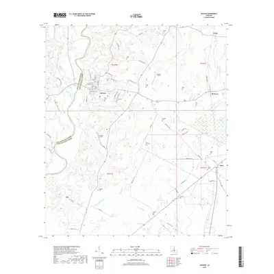
2018 Map of Jackson
USGS Topo · Published 2018About this map
Jackson anchors this portion of East Feliciana Parish, where the grid of the town center transitions into a landscape defined by meandering bayous and family-named cemeteries. The town’s historical footprint is visible through its street network, including Market St, College St, and Asylum Cr, which flows south toward Cooks Br. This 2018 survey reveals a terrain heavily influenced by water, from the wide channel of Thompson Creek along the western parish boundary to the network of smaller streams like Iron Bayou and White Bayou that carve through the surrounding woodlands. Local history and genealogy researchers will find an exceptional concentration of burial sites throughout the quadrangle, such as the Asphodel Cem, Evergreen Cem, and Green Briar Cem. Small airfields like Howell 1 Airport and Feliciana Airpark punctuate the rural stretches between outlying settlements like McManus, Ethel, and Gurley.
Find a feature on this map
86 named features on this map. Tap any name to fly to it.
Don’t see what you’re looking for? This feature index may not catch every label — zoom into the map to look around manually.
Map Details
Editions of this 2018 Jackson Map
This is the sole edition of this map. No revisions or reprints were ever made.
Other maps of this area

1906 · Bayou Sara
USGS Topo · 1:125,000

1939 · St. Francisville
USGS Topo · 1:62,500

1939 · Zachary
USGS Topo · 1:62,500

1941 · Norwood
USGS Topo · 1:31,680

1941 · Lost Creek
USGS Topo · 1:31,680

1945 · Norwood
USGS Topo · 1:31,680

1945 · Jackson
USGS Topo · 1:31,680

1945 · Lost Creek
USGS Topo · 1:31,680

1946 · Clinton
USGS Topo · 1:31,680

1954 · Zachary
USGS Topo · 1:24,000