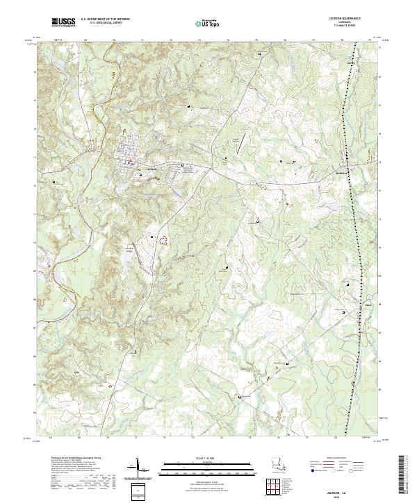
2024 Map of Jackson
USGS Topo · Published 2024About this map
Jackson anchors the landscape where the West and East Feliciana Parish boundary follows the winding course of Thompson Creek. This interior region of Louisiana is characterized by an intricate drainage system of bayous and creeks, including White Bayou, Iron Bayou, and Hog Bayou, which carve through the terrain south of the Jackson town center. The town's historical fabric is evident in its street grid, featuring names like College St and Church St, and the presence of the Second Baptist Church. Educational and aviation hubs such as Baton Rouge Community College Jackson, Feliciana Airpark, and Howell Airport indicate the area's modern utility. Numerous family and community burial grounds, such as the Keller Family Cem and Asphodel Cem, are scattered throughout the rural stretches, offering significant points of interest for genealogical research near the settlements of McManus and Ethel.
Find a feature on this map
93 named features on this map. Tap any name to fly to it.
Don’t see what you’re looking for? This feature index may not catch every label — zoom into the map to look around manually.
Map Details
Editions of this 2024 Jackson Map
This is the sole edition of this map. No revisions or reprints were ever made.
Other maps of this area

1906 · Bayou Sara
USGS Topo · 1:125,000

1939 · St. Francisville
USGS Topo · 1:62,500

1939 · Zachary
USGS Topo · 1:62,500

1941 · Norwood
USGS Topo · 1:31,680

1941 · Lost Creek
USGS Topo · 1:31,680

1945 · Norwood
USGS Topo · 1:31,680

1945 · Jackson
USGS Topo · 1:31,680

1945 · Lost Creek
USGS Topo · 1:31,680

1946 · Clinton
USGS Topo · 1:31,680

1954 · Zachary
USGS Topo · 1:24,000