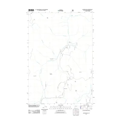
2011 Map of Jackson Hill
USGS Topo · Published 2011About this map
Carney Mine sits near the southern boundary of this high-elevation terrain in Beaverhead County, highlighting the region's historical mining activity. The landscape is defined by a series of open parks and mountain peaks, including Woody Mountain and Jackson Hill. Water drainages like Warm Springs Creek and Jackson Creek carve through the topography, leading toward established grazing areas and mountain camps such as Clemow Cow Camp.
Find a feature on this map
31 named features on this map. Tap any name to fly to it.
Don’t see what you’re looking for? This feature index may not catch every label — zoom into the map to look around manually.
Map Details
Editions of this 2011 Jackson Hill Map
This is the sole edition of this map. No revisions or reprints were ever made.
Other maps of this area

1955 · Dillon
USGS Topo · 1:250,000

1957 · Dillon
USGS Topo · 1:250,000

1958 · Dillon
USGS Topo · 1:250,000

1959 · Polaris
USGS Topo · 1:62,500

1962 · Dillon
USGS Topo · 1:250,000

1962 · Wisdom
USGS Topo · 1:24,000

1962 · Stewart Mountain
USGS Topo · 1:24,000

1965 · Dillon
USGS Topo · 1:250,000
1978 · Odell Lake
USGS Topo · 1:24,000
1978 · Jackson
USGS Topo · 1:24,000