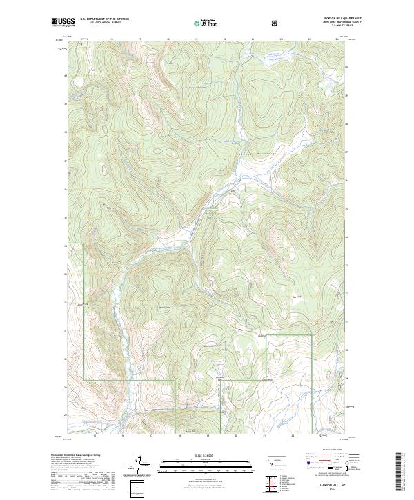
2024 Map of Jackson Hill
USGS Topo · Published 2024About this map
Beaverhead National Forest land dominates this section of the Pioneer Mountains, where the high-altitude landscape is defined by clearings like Richards Park and Star Park. The terrain is deeply carved by drainage systems including Warm Springs Creek and Jackson Creek, which flow through features like Knight Gulch. The presence of Jardine Ditch Number One and Wengers Ditch indicates the historical importance of water management in this high-country environment. Prominent peaks such as Woody Mtn, Jackson Hill, and Butch Hill rise above the forest, connected by a network of specialized access routes including Woody Mountain Rd and Little Milk Creek Rd. This map captures a landscape where the natural alpine meadow system meets industrial-era water engineering.
Find a feature on this map
53 named features on this map. Tap any name to fly to it.
Don’t see what you’re looking for? This feature index may not catch every label — zoom into the map to look around manually.
Map Details
Editions of this 2024 Jackson Hill Map
This is the sole edition of this map. No revisions or reprints were ever made.
Other maps of this area

1955 · Dillon
USGS Topo · 1:250,000

1957 · Dillon
USGS Topo · 1:250,000

1958 · Dillon
USGS Topo · 1:250,000

1959 · Polaris
USGS Topo · 1:62,500

1962 · Dillon
USGS Topo · 1:250,000

1962 · Wisdom
USGS Topo · 1:24,000

1962 · Stewart Mountain
USGS Topo · 1:24,000

1965 · Dillon
USGS Topo · 1:250,000
1978 · Odell Lake
USGS Topo · 1:24,000
1978 · Jackson
USGS Topo · 1:24,000