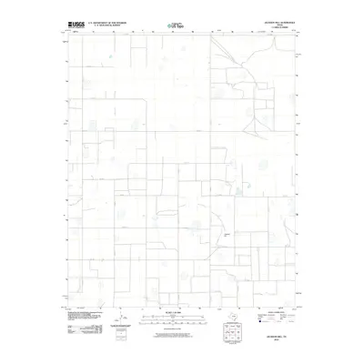
2010 Map of Jackson Hill
USGS Topo · Published 2010About this map
Jackson Hill rises as a distinct topographical point within this section of Swisher County, where the high plains landscape is defined by a rigorous grid of section lines and rural farm-to-market roads. The area shows a highly organized agricultural layout, with long-established transit corridors like FM 2301 and FM 146 intersecting near the hill. Numerous playa lakes and depressions are scattered across the terrain, illustrating the natural drainage patterns that coexist with the heavy human imprint of rural engineering. The presence of named tracks such as Zulu Rd and a sequence of county roads from Co Rd B to Co Rd 28 provides a detailed framework for tracing local property boundaries and historic farmstead locations in this part of the Texas Panhandle during the early 21st century.
Find a feature on this map
20 named features on this map. Tap any name to fly to it.
Don’t see what you’re looking for? This feature index may not catch every label — zoom into the map to look around manually.
Map Details
Editions of this 2010 Jackson Hill Map
This is the sole edition of this map. No revisions or reprints were ever made.
Other maps of this area

1954 · Plainview
USGS Topo · 1:250,000

1958 · Plainview
USGS Topo · 1:250,000

1960 · Wayside
USGS Topo · 1:62,500

1963 · Pleasant Creek
USGS Topo · 1:24,000

1965 · Vigo Park
USGS Topo · 1:24,000

1965 · Cope Creek
USGS Topo · 1:24,000

1968 · Tule Lake
USGS Topo · 1:24,000

1969 · Love
USGS Topo · 1:24,000

1969 · Jackson Hill
USGS Topo · 1:24,000

1969 · Tule Lake NW
USGS Topo · 1:24,000