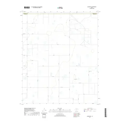
2019 Map of Jackson Hill
USGS Topo · Published 2019About this map
The boundary between Armstrong Co and Swisher Co defines the northern reaches of this High Plains landscape. Located in a region of the Texas Panhandle characterized by ephemeral playa lakes and expansive agricultural tracts, the area is anchored by the prominent rise of Jackson Hill. This topographic feature stands as a landmark amidst the grid of county roads, providing a rare point of elevation in an otherwise level terrain. The human footprint is traced through a network of farm-to-market and ranch roads, including FM 2301 and Ranch Rd 146, which facilitate movement between scattered homesteads. Near the eastern edge of the survey, the Vigo Park Cem serves as a vital touchpoint for local genealogy and heritage, marking a settled community presence in this wide-open ranching country. The grid-like organization of routes such as Zulu Rd and Co Rd 25 reflects the modern agricultural management of the Llano Estacado.
Find a feature on this map
24 named features on this map. Tap any name to fly to it.
Don’t see what you’re looking for? This feature index may not catch every label — zoom into the map to look around manually.
Map Details
Editions of this 2019 Jackson Hill Map
This is the sole edition of this map. No revisions or reprints were ever made.
Other maps of this area

1954 · Plainview
USGS Topo · 1:250,000

1958 · Plainview
USGS Topo · 1:250,000

1960 · Wayside
USGS Topo · 1:62,500

1963 · Pleasant Creek
USGS Topo · 1:24,000

1965 · Vigo Park
USGS Topo · 1:24,000

1965 · Cope Creek
USGS Topo · 1:24,000

1968 · Tule Lake
USGS Topo · 1:24,000

1969 · Love
USGS Topo · 1:24,000

1969 · Jackson Hill
USGS Topo · 1:24,000

1969 · Tule Lake NW
USGS Topo · 1:24,000