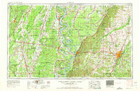
1962 Map of Jackson
USGS Topo · Published 1962About this map
The Mississippi River creates a meandering border between Louisiana and Mississippi in this 1962 revision, defining a landscape of oxbow lakes and fertile delta lowlands. The industrial and transit hubs of Vicksburg and Jackson anchor the eastern half of the sheet, connected by the heavy infrastructure of the Illinois Central RR and U.S. 80. The intricate hydrology of the region is evident in the numerous water bodies like Eagle Lake, Lake Bruin, and the serpentining Yazoo River. On the Louisiana side, settlements such as Lake Providence and Tallulah sit among a grid of drainage canals and bayous including Bayou Macon and the Tensas River. This survey captures the mid-century transition of the Deep South, showing the dense network of small towns like Rolling Fork and Port Gibson that grew alongside the river-and-rail economy.
Find a feature on this map
254 named features on this map. Tap any name to fly to it.
Don’t see what you’re looking for? This feature index may not catch every label — zoom into the map to look around manually.
Map Details
Editions of this 1962 Jackson Map
2 editions found

Other maps of this area

1903 · Jackson
USGS Topo · 1:125,000

1905 · Jackson
USGS Topo · 1:48,000

1906 · Florence
USGS Topo · 1:62,500

1908 · Jackson
USGS Topo · 1:62,500

1908 · Florence
USGS Topo · 1:62,500

1909 · Delta Bridge
USGS Topo · 1:24,000

1909 · Lake Bruen
USGS Topo · 1:24,000

1909 · Baxter Bayou
USGS Topo · 1:24,000

1909 · Millikens Bend
USGS Topo · 1:24,000

1909 · Lake Providence
USGS Topo · 1:24,000