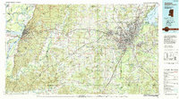
1984 Map of Jackson
USGS Topo · Published 1984About this map
Vicksburg and Jackson anchor this mid-1980s landscape, illustrating the regional infrastructure between the Mississippi River and the Pearl River. The corridor is defined by the Illinois Central Gulf railroad and Interstate 20, which link smaller communities like Edwards, Bolton, and Clinton. This era shows the developed footprint of the Ross R Barnett Reservoir to the northeast and the expansive grounds of the Mississippi State Hospital at Whitfield. Away from the urban centers, the map documents numerous rural landmarks, including Utica College and several country churches such as Oak Ridge Ch and Bethesda Ch. The intricate hydrology of the Big Black River basin, with its many oxbows like Eagle Lake and Centennial Lake, highlights the complex alluvial terrain that has historically dictated settlement patterns and transport routes in central Mississippi.
Find a feature on this map
138 named features on this map. Tap any name to fly to it.
Don’t see what you’re looking for? This feature index may not catch every label — zoom into the map to look around manually.
Map Details
Editions of this 1984 Jackson Map
This is the sole edition of this map. No revisions or reprints were ever made.
Other maps of this area

1903 · Jackson
USGS Topo · 1:125,000

1905 · Jackson
USGS Topo · 1:48,000

1906 · Florence
USGS Topo · 1:62,500

1908 · Jackson
USGS Topo · 1:62,500

1908 · Florence
USGS Topo · 1:62,500

1909 · Millikens Bend
USGS Topo · 1:24,000

1909 · Mound
USGS Topo · 1:24,000

1910 · Mound
USGS Topo · 1:31,680

1918 · Vicksburg
USGS Topo · 1:62,500

1922 · Pelahatchee
USGS Topo · 1:48,000