
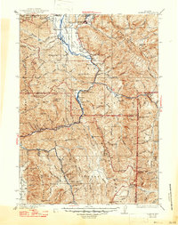
1935 Map of Jackson
USGS Topo · Published 1935About this map
Jackson Hole serves as the focal point of this mid-1930s survey, where the Snake River converges with Flat Creek and Fish Creek near the settlement of Jackson. The landscape is dominated by the intersecting heights of the Teton Range, Gros Ventre Range, and Wyoming Range, detailing a region defined by high-altitude cattle ranching and early conservation efforts. Notable local landmarks include the Elk Refuge and the Bull Hollow Guard Sta, alongside smaller community features like the Porcupine Sch and Etna Cem. The early path of U S Highway 187 follows the river valleys, connecting isolated outposts such as Hoback and Browns Ranch. This map captures the area before modern development, showing a network of remote mining operations like the Jackson Mine and several ranger stations scattered through the surrounding national forests.
Find a feature on this map
92 named features on this map. Tap any name to fly to it.
Don’t see what you’re looking for? This feature index may not catch every label — zoom into the map to look around manually.
Map Details
Editions of this 1935 Jackson Map
2 editions found
Other maps of this area

1899 · Grand Teton
USGS Topo · 1:125,000

1901 · Grand Teton
USGS Topo · 1:125,000

1902 · Mt Leidy
USGS Topo · 1:125,000

1907 · Gros Ventre
USGS Topo · 1:125,000

1910 · Gros Ventre
USGS Topo · 1:125,000

1915 · Freedom
USGS Topo · 1:62,500

1921 · Afton
USGS Topo · 1:125,000

1931 · Jackson
USGS Topo · 1:125,000

1932 · Irwin
USGS Topo · 1:96,000

1935 · Irwin
USGS Topo · 1:125,000