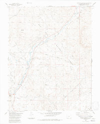
1984 Map of Jackson Mountain
USGS Topo · Published 1984About this map
Pagosa Springs serves as the southwestern anchor of this 1984 survey, situated where the San Juan River flows toward the foothills. The landscape is dominated by the elevations of Jackson Mountain and the expansive tracts of the San Juan National Forest. The map documents a complex irrigation network essential to the high-altitude terrain, featuring the Snowball Ditch, Highline Ditch, and Extention Ditch that wind through the river valleys. Evidence of the local economy and infrastructure is clear, from the Rodeo Ground near the town center to the Gaging Sta on the West Fork San Juan River. Further east, the New Mexico Principal Meridian serves as a critical surveying boundary, while several Prospect sites and a Gravel Pit indicate localized mineral and resource extraction during the late 1970s and early 1980s.
Find a feature on this map
41 named features on this map. Tap any name to fly to it.
Don’t see what you’re looking for? This feature index may not catch every label — zoom into the map to look around manually.
Map Details
Editions of this 1984 Jackson Mountain Map
4 editions found
Other maps of this area

1913 · Summitville
USGS Topo · 1:125,000

1915 · Summitville
USGS Topo · 1:125,000

1924 · Pagosa Springs
USGS Topo · 1:125,000

1927 · Pagosa Springs
USGS Topo · 1:125,000

1945 · Durango
USGS Topo · 1:250,000

1953 · Durango
USGS Topo · 1:250,000

1954 · Durango
USGS Topo · 1:250,000

1957 · Chromo
USGS Topo · 1:62,500

1957 · Wolf Creek Pass
USGS Topo · 1:62,500

1957 · Pagosa Junction
USGS Topo · 1:62,500