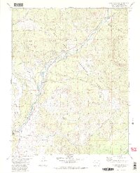
1984 Map of Jackson Mountain
USGS Topo · Published 1984About this map
The San Juan River carves through the heart of this landscape, fed by the West Fork and East Fork as it flows south toward Pagosa Springs. This 1984 survey documents the rugged intersection of water management and forest recreation within the San Juan National Forest. A complex network of irrigation infrastructure is evident, including the Snowball Extention Ditch, Highline Ditch, and Echo Ditch, which redirect water across the varied terrain of Jackson Mountain and Laughlin Park.
Find a feature on this map
41 named features on this map. Tap any name to fly to it.
Don’t see what you’re looking for? This feature index may not catch every label — zoom into the map to look around manually.
Map Details
Editions of this 1984 Jackson Mountain Map
4 editions found
Other maps of this area

1913 · Summitville
USGS Topo · 1:125,000

1915 · Summitville
USGS Topo · 1:125,000

1924 · Pagosa Springs
USGS Topo · 1:125,000

1927 · Pagosa Springs
USGS Topo · 1:125,000

1945 · Durango
USGS Topo · 1:250,000

1953 · Durango
USGS Topo · 1:250,000

1954 · Durango
USGS Topo · 1:250,000

1957 · Chromo
USGS Topo · 1:62,500

1957 · Wolf Creek Pass
USGS Topo · 1:62,500

1957 · Pagosa Junction
USGS Topo · 1:62,500