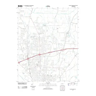
2010 Map of Jackson North
USGS Topo · Published 2010About this map
The Middle Fork Forked Deer River and the South Fork Forked Deer River frame a landscape defined by significant infrastructure and historical burial grounds just north of the city center. The map reveals a sophisticated network of water management, featuring reservoirs like Lake DeForest and the industrial-titled Construction Products Lake, both secured by their namesake dams. This 2010 survey illustrates the northward reach of suburban and industrial development along the Hwy 45 Byp and the modern interchanges of the Vann Dr corridor.
Find a feature on this map
52 named features on this map. Tap any name to fly to it.
Don’t see what you’re looking for? This feature index may not catch every label — zoom into the map to look around manually.
Map Details
Editions of this 2010 Jackson North Map
This is the sole edition of this map. No revisions or reprints were ever made.
Other maps of this area

1950 · Jackson South
USGS Topo · 1:24,000

1950 · Jackson North
USGS Topo · 1:24,000

1951 · Jackson North
USGS Topo · 1:24,000

1953 · Claybrook
USGS Topo · 1:24,000

1953 · Beech Bluff
USGS Topo · 1:24,000

1956 · Blytheville
USGS Topo · 1:250,000

1959 · Medina
USGS Topo · 1:24,000

1959 · Blytheville
USGS Topo · 1:250,000

1959 · Westover
USGS Topo · 1:24,000

1959 · Adair
USGS Topo · 1:24,000