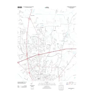
2013 Map of Jackson North
USGS Topo · Published 2013About this map
Youngs Crossing and Carroll occupy the northern reaches of this Madison County landscape, where the Middle Fork Forked Deer River winds through the drainage basin. The map illustrates a period of significant suburban infill and residential expansion north of the city center, shown through the dense network of streets in Hicksville and Westwood Gardens. The presence of industrial and commercial landmarks like the Construction Products Lake and the Gerdau Ameristeel Rd reflects the local economy of the early 21st century. Smaller, established nodes like Oakfield and the Nichols Farm persist amid the growing street grid, while water features such as Lake DeForest and Sandy Cr provide a natural framework for the modern developments and established neighborhoods of the region.
Find a feature on this map
299 named features on this map. Tap any name to fly to it.
Don’t see what you’re looking for? This feature index may not catch every label — zoom into the map to look around manually.
Map Details
Editions of this 2013 Jackson North Map
This is the sole edition of this map. No revisions or reprints were ever made.
Other maps of this area

1950 · Jackson South
USGS Topo · 1:24,000

1950 · Jackson North
USGS Topo · 1:24,000

1951 · Jackson North
USGS Topo · 1:24,000

1953 · Claybrook
USGS Topo · 1:24,000

1953 · Beech Bluff
USGS Topo · 1:24,000

1956 · Blytheville
USGS Topo · 1:250,000

1959 · Medina
USGS Topo · 1:24,000

1959 · Blytheville
USGS Topo · 1:250,000

1959 · Westover
USGS Topo · 1:24,000

1959 · Adair
USGS Topo · 1:24,000