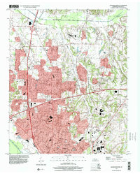
1997 Map of Jackson North
USGS Topo · Published 2001About this map
Jackson dominates the southern reaches of this landscape, where the urban expansion of Westwood Gardens and Hicksville pushes northward into the rural Tennessee countryside. The terrain is defined by the drainage systems of the Middle Fork Forked Deer River and the South Fork Forked Deer River, with smaller tributaries like Dyer Creek and Turkey Creek carving through the agricultural land. Smaller outlying settlements such as Oakfield, Carroll, and Youngs Crossing reflect the historical rural network that existed before the city's significant late-20th-century growth.
Find a feature on this map
40 named features on this map. Tap any name to fly to it.
Don’t see what you’re looking for? This feature index may not catch every label — zoom into the map to look around manually.
Map Details
Editions of this 1997 Jackson North Map
This is the sole edition of this map. No revisions or reprints were ever made.
Other maps of this area

1950 · Jackson South
USGS Topo · 1:24,000

1950 · Jackson North
USGS Topo · 1:24,000

1951 · Jackson North
USGS Topo · 1:24,000

1953 · Claybrook
USGS Topo · 1:24,000

1953 · Beech Bluff
USGS Topo · 1:24,000

1956 · Blytheville
USGS Topo · 1:250,000

1959 · Medina
USGS Topo · 1:24,000

1959 · Blytheville
USGS Topo · 1:250,000

1959 · Westover
USGS Topo · 1:24,000

1959 · Adair
USGS Topo · 1:24,000