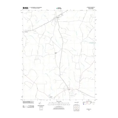
2010 Map of Jackson
USGS Topo · Published 2010About this map
Jackson serves as a primary hub in this corner of Northampton County, anchored by a grid of streets including Grant St and Depot St. The surrounding landscape is defined by an extensive network of wetlands and slow-moving waters, such as the Wiccacane Swamp, Corduroy Swamp, and Gumberry Swamp. These swamp systems are interspersed with agricultural lands and smaller settlements like Seaboard and Gumberry.
Find a feature on this map
42 named features on this map. Tap any name to fly to it.
Don’t see what you’re looking for? This feature index may not catch every label — zoom into the map to look around manually.
Map Details
Editions of this 2010 Jackson Map
This is the sole edition of this map. No revisions or reprints were ever made.
Other maps of this area

1919 · Emporia
USGS Topo · 1:62,500

1919 · Arringdale
USGS Topo · 1:48,000

1920 · Arringdale
USGS Topo · 1:62,500

1942 · Arringdale
USGS Topo · 1:62,500

1942 · Emporia
USGS Topo · 1:62,500

1953 · Norfolk
USGS Topo · 1:250,000

1963 · Skippers
USGS Topo · 1:24,000

1966 · Margarettsville
USGS Topo · 1:24,000
1966 · Claresville
USGS Topo · 1:24,000

1974 · Halifax
USGS Topo · 1:24,000