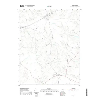
2019 Map of Jackson
USGS Topo · Published 2019About this map
Jackson and Seaboard anchor this portrait of Northampton County, where the landscape is defined by the winding drainages of the Wiccacane Swamp and Gumberry Swamp. At Jackson, the street grid extends from W Jefferson St and E Jefferson St, while to the north, Seaboard is shaped by the corridor of Railroad St. Between these primary settlements, smaller communities like Pleasant Grove and Gumberry sit along rural connectors. The topography is marked by significant water features such as Boones Millpond and Taylors Millpond, reflecting the importance of controlled waterways in this part of North Carolina. Local history is etched into the landscape at Phillips Cem and along family-named routes like Henry Kee Rd and Buck Howell Rd, which provide clear markers for genealogical research and property identification within these traditional coastal plain drainage basins.
Find a feature on this map
56 named features on this map. Tap any name to fly to it.
Don’t see what you’re looking for? This feature index may not catch every label — zoom into the map to look around manually.
Map Details
Editions of this 2019 Jackson Map
This is the sole edition of this map. No revisions or reprints were ever made.
Other maps of this area

1919 · Emporia
USGS Topo · 1:62,500

1919 · Arringdale
USGS Topo · 1:48,000

1920 · Arringdale
USGS Topo · 1:62,500

1942 · Arringdale
USGS Topo · 1:62,500

1942 · Emporia
USGS Topo · 1:62,500

1953 · Norfolk
USGS Topo · 1:250,000

1963 · Skippers
USGS Topo · 1:24,000

1966 · Margarettsville
USGS Topo · 1:24,000
1966 · Claresville
USGS Topo · 1:24,000

1974 · Halifax
USGS Topo · 1:24,000