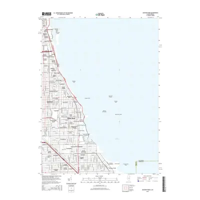
2015 Map of Jackson Park
USGS Topo · Published 2015About this map
The south side of Chicago's lakefront is defined by its prestigious institutions and historic residential enclaves. This survey documents the dense corridor between the Metra rail lines and the waters of Lake Michigan, anchored by the University of Chicago and its cluster of academic and theological landmarks, including the McCormick Theological Seminary and Meadville Lombard Theological School. The landscape transitions from the managed green space of Jackson Park, which features the Wooded Island, to the early industrial and residential roots of neighborhoods like Kenwood and Woodlawn.
Find a feature on this map
138 named features on this map. Tap any name to fly to it.
Don’t see what you’re looking for? This feature index may not catch every label — zoom into the map to look around manually.
Map Details
Editions of this 2015 Jackson Park Map
This is the sole edition of this map. No revisions or reprints were ever made.
Other maps of this area

1889 · Chicago
USGS Topo · 1:62,500

1891 · Chicago
USGS Topo · 1:62,500

1892 · Calumet
USGS Topo · 1:62,500

1893 · Calumet
USGS Topo · 1:62,500

1900 · Chicago
USGS Topo · 1:62,500

1900 · Toleston
USGS Topo · 1:62,500

1900 · Calumet
USGS Topo · 1:62,500

1901 · Calumet
USGS Topo · 1:62,500

1901 · Chicago
USGS Topo · 1:62,500

1929 · Calumet Lake
USGS Topo · 1:24,000