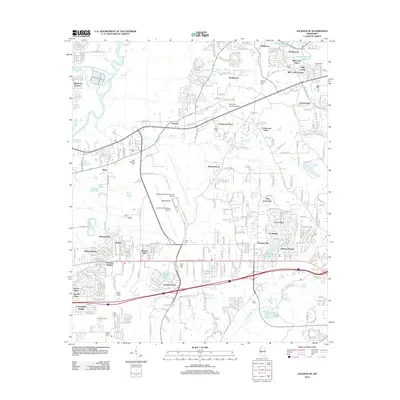
2012 Map of Jackson SE
USGS Topo · Published 2012About this map
The Pearl River corridor and its surrounding residential developments define this suburban landscape southeast of Jackson in the early twenty-first century. Massive infrastructure projects dominate the terrain, notably the extensive grounds of the Jackson-Evers International Airport and the southern edge of the Ross R Barnett Reservoir. Between these large-scale footprints lies a network of established neighborhoods and newer subdivisions, including Sherwood Forest, Castlewoods, and Skyway Hills. Historically significant sites are preserved amidst the modern growth, such as Saint Matthew Ch and several burial grounds like Drakes Cem and Liberty Cem. The area’s varied hydrology is evident through numerous water bodies, from the winding Terrapin Skin Cr to the localized Crossgates Lake. This survey provides a clear look at the region’s suburban transformation, where former switch points like Rice Switch have been absorbed into a landscape of parks and planned communities like The Commons and Grove Park.
Find a feature on this map
52 named features on this map. Tap any name to fly to it.
Don’t see what you’re looking for? This feature index may not catch every label — zoom into the map to look around manually.
Map Details
Editions of this 2012 Jackson SE Map
This is the sole edition of this map. No revisions or reprints were ever made.
Other maps of this area

1903 · Jackson
USGS Topo · 1:125,000

1905 · Jackson
USGS Topo · 1:48,000

1906 · Florence
USGS Topo · 1:62,500

1908 · Jackson
USGS Topo · 1:62,500

1908 · Florence
USGS Topo · 1:62,500

1922 · Pelahatchee
USGS Topo · 1:48,000

1924 · Pelahatchee
USGS Topo · 1:62,500

1950 · Pelahatchie
USGS Topo · 1:62,500

1952 · Pelahatchie
USGS Topo · 1:62,500

1953 · Meridian
USGS Topo · 1:250,000