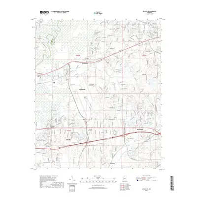
2018 Map of Jackson SE
USGS Topo · Published 2018About this map
The Jackson-Medgar Wiley Evers International Airport serves as a massive focal point for this 2018 study of the eastern Jackson metropolitan area, situated where the Rankin and Hinds county lines meet. The landscape is a complex mix of rapid suburban expansion and significant transit corridors, with the Kansas City Southern railroad and Highway 80 cutting through the heart of Pearl and McLaurin Heights. Local history is preserved in numerous burial grounds like Saint Matthew Cem and the Mount Olive Cem, while the northern edge is defined by the Ross R Barnett Reservoir. Educational and industrial growth is evident through Hinds Community College Rankin Campus and Antonelli College, showing how the modern suburban clusters of Flowood and Brandon have evolved around the natural features of Bald Prairie and the Pearl River.
Find a feature on this map
159 named features on this map. Tap any name to fly to it.
Don’t see what you’re looking for? This feature index may not catch every label — zoom into the map to look around manually.
Map Details
Editions of this 2018 Jackson SE Map
This is the sole edition of this map. No revisions or reprints were ever made.
Other maps of this area

1903 · Jackson
USGS Topo · 1:125,000

1905 · Jackson
USGS Topo · 1:48,000

1906 · Florence
USGS Topo · 1:62,500

1908 · Jackson
USGS Topo · 1:62,500

1908 · Florence
USGS Topo · 1:62,500

1922 · Pelahatchee
USGS Topo · 1:48,000

1924 · Pelahatchee
USGS Topo · 1:62,500

1950 · Pelahatchie
USGS Topo · 1:62,500

1952 · Pelahatchie
USGS Topo · 1:62,500

1953 · Meridian
USGS Topo · 1:250,000