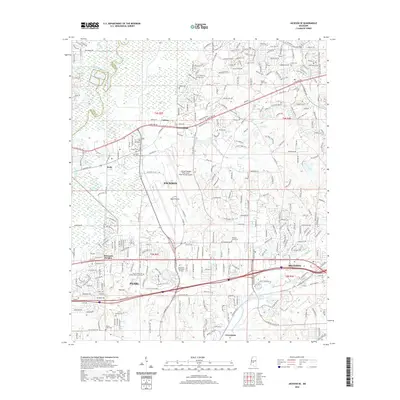
2020 Map of Jackson SE
USGS Topo · Published 2020About this map
The Jackson-Medgar Wiley Evers International Airport dominates the central landscape of this survey, surrounded by the rapidly developing suburbs of Rankin County. Positioned east of the Pearl River, the area shows a dense network of residential streets and arterial roads connecting the cities of Pearl, Flowood, and Brandon. This 21st-century mapping reveals a landscape where modern infrastructure meets historic roots, evidenced by the numerous burial grounds scattered across the terrain, including the Saint Matthew Cem and the Old Sea Cem. Educational and industrial growth is anchored by the Hinds Community College Rankin Campus and the KCS rail line. Beyond the suburban sprawl, natural remnants like the Bald Prairie and winding watercourses such as Hanging Moss Creek and Hog Cr define the original geography of this Mississippi heartland.
Find a feature on this map
296 named features on this map. Tap any name to fly to it.
Don’t see what you’re looking for? This feature index may not catch every label — zoom into the map to look around manually.
Map Details
Editions of this 2020 Jackson SE Map
This is the sole edition of this map. No revisions or reprints were ever made.
Other maps of this area

1903 · Jackson
USGS Topo · 1:125,000

1905 · Jackson
USGS Topo · 1:48,000

1906 · Florence
USGS Topo · 1:62,500

1908 · Jackson
USGS Topo · 1:62,500

1908 · Florence
USGS Topo · 1:62,500

1922 · Pelahatchee
USGS Topo · 1:48,000

1924 · Pelahatchee
USGS Topo · 1:62,500

1950 · Pelahatchie
USGS Topo · 1:62,500

1952 · Pelahatchie
USGS Topo · 1:62,500

1953 · Meridian
USGS Topo · 1:250,000