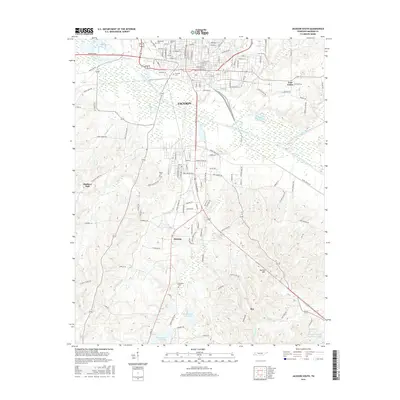
2016 Map of Jackson South
USGS Topo · Published 2016About this map
The South Fork Forked Deer River winds through the southern half of the Jackson urban area, creating a wide corridor of wetlands and tributaries that define the local geography. To the north, the street grid of the city is densely developed around landmarks like Lambuth Univ and the historic Riverside Cem. As the map transitions south of the river, the landscape becomes more rural, punctuated by smaller residential clusters and agricultural land near Malesus and Madison Hall. This 2016 survey illustrates the balance between the expanding infrastructure of Madison County and the natural drainage systems of Bond Creek and Sandy Cr. Regional history is preserved in several family and community burial grounds, including Ebenezer Cem and Bemis Cem, which serve as quiet anchors for the outlying communities of Roy and Norton Hill.
Find a feature on this map
96 named features on this map. Tap any name to fly to it.
Don’t see what you’re looking for? This feature index may not catch every label — zoom into the map to look around manually.
Map Details
Editions of this 2016 Jackson South Map
This is the sole edition of this map. No revisions or reprints were ever made.
Other maps of this area

1950 · Jackson South
USGS Topo · 1:24,000

1950 · Jackson North
USGS Topo · 1:24,000

1951 · Jackson North
USGS Topo · 1:24,000

1953 · Claybrook
USGS Topo · 1:24,000

1953 · Beech Bluff
USGS Topo · 1:24,000

1956 · Blytheville
USGS Topo · 1:250,000

1959 · Blytheville
USGS Topo · 1:250,000

1959 · Westover
USGS Topo · 1:24,000

1959 · Adair
USGS Topo · 1:24,000

1961 · Medon
USGS Topo · 1:24,000