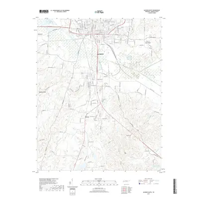
2019 Map of Jackson South
USGS Topo · Published 2019About this map
Jackson anchors the landscape in this recent study of Madison County, showing the southern expansion of the city toward the community of Malesus. The city’s historic fabric is clearly visible through the presence of Hollywood Cem and Riverside Cem near the banks of the South Fork Forked Deer River. The terrain transitions from the dense street grids of downtown, including Airways Blvd and N Highland Ave, into the winding rural roads of the south. Smaller surrounding settlements like Westover, East Union, and Madison Hall provide local context for the region's development. Notable water features, including Bond Creek and the Tennessee Sheriffs Youthtown Lake, segment the rolling topography, while remote sites such as Ebenezer Cem and Norton Hill offer specific points of interest for genealogists and local historians tracking family landmarks.
Find a feature on this map
146 named features on this map. Tap any name to fly to it.
Don’t see what you’re looking for? This feature index may not catch every label — zoom into the map to look around manually.
Map Details
Editions of this 2019 Jackson South Map
This is the sole edition of this map. No revisions or reprints were ever made.
Other maps of this area

1950 · Jackson South
USGS Topo · 1:24,000

1950 · Jackson North
USGS Topo · 1:24,000

1951 · Jackson North
USGS Topo · 1:24,000

1953 · Claybrook
USGS Topo · 1:24,000

1953 · Beech Bluff
USGS Topo · 1:24,000

1956 · Blytheville
USGS Topo · 1:250,000

1959 · Blytheville
USGS Topo · 1:250,000

1959 · Westover
USGS Topo · 1:24,000

1959 · Adair
USGS Topo · 1:24,000

1961 · Medon
USGS Topo · 1:24,000